
Naperville ZIP Coverage at a Glance
Four ZIPs form the practical street-delivery set for Naperville resident and address searches. Two more labels appear in official postal routing and city mailing records, but they need a box or ancillary-use warning. Area descriptions below come from City permit and facility examples plus USPS routing material. They are search guides, not legal boundaries. Confirm each full address with the current postal lookup and the municipal boundary layer.
| ZIP Code | Areas Covered | Post Office | Notes |
|---|---|---|---|
| 60540 | Core, older, west, and central examples | Naperville street delivery | USPS routing material pairs it with 60567 |
| 60563 | North, central, northwest, and I-88-side examples | Naperville street delivery | Includes Naper Commons and Northwoods examples |
| 60564 | South, southwest, and east development examples | Naperville street delivery | Many addresses are on the Will County side |
| 60565 | East, northeast, and older east or south-central examples | Naperville street delivery | Used in City facility and permit records |
| 60566 | Official Naperville routing and mailing references | Ancillary or PO-box label | Confirm the specific box or address with USPS |
| 60567 | Official Naperville routing references | Ancillary or PO-box label | Not a substitute for a street-delivery ZIP |
The Naperville ZIP code directory therefore keeps all six labels visible but does not count them alike. Search parcels and address points first with 60540, 60563, 60564, or 60565. Treat 60566 and 60567 as postal leads until the USPS address lookup confirms a current use. This avoids turning a city PO box into a supposed residential parcel.
Read Naperville Postal Labels
USPS designed ZIPs to route mail, not to describe municipal government. The USPS ZIP basics explains why the standardized mailing city and code should be checked for a full address. A postal place name can extend beyond the incorporated city, and an address inside a city can sometimes use a different preferred postal label. Neither outcome changes the parcel's legal county or taxing districts.
The distinction is sharp in Naperville. USPS bulletin material associates 60566 and 60567 with Naperville routing, and older City mail references use these labels. The research did not expose a current public classification screen for every use, so they should not be described as populated residential zones. Enter the street address or box in the live lookup. Preserve the returned preferred city and ZIP exactly.
The captured USPS routing bulletin shows the official source used to connect these labels with Naperville mail handling.
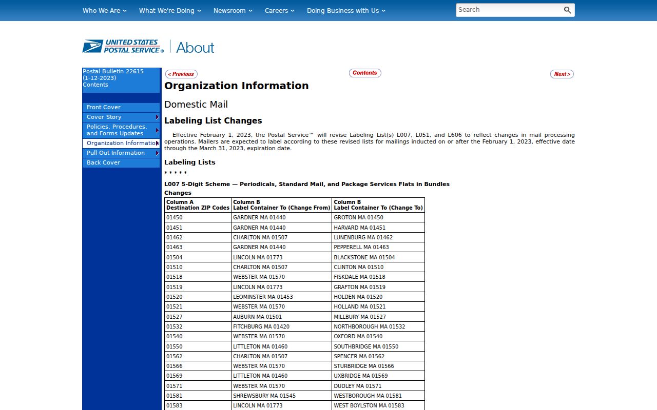
Because a routing pair is not a boundary map, the full address must still be tested in USPS lookup and City GIS.
Route Naperville ZIP Records
A ZIP cannot select the correct county office on its own. Naperville spans DuPage and Will counties, with 87th Street serving as the City's basic north-south routing clue. South-side 60564 examples often lie in Will County, but a parcel check is stronger than the shortcut. Search the City's municipal boundary and address point, copy the PIN, then open the assessor, recorder, clerk, court, or election authority for that county.
Township geography adds another layer. The City lists Naperville and Lisle townships north of 87th Street, Wheatland and DuPage townships to the south, and small portions of Winfield and Milton. Washington Street also serves as a township divider in the City's account. The Naperville township reference is especially useful when an older roll or tax record files an address under township rather than city.
The manifest capture of that township page preserves the local geography behind a ZIP search.
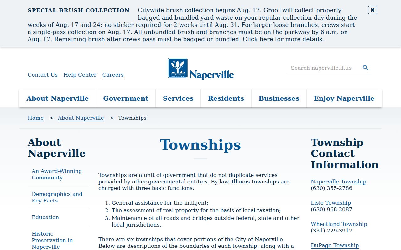
The six-township pattern explains why two records with the same postal city may be kept under different local jurisdictions.
Search Naperville Residents by ZIP
Not every official system offers a ZIP-wide browse. DuPage Parcel Viewer accepts property ZIP code in Advanced Search and returns parcel results, not a resident list. The Naperville address-point layer includes a ZIP field and can show how a postal code overlaps the municipal boundary. Will's documented assessor search asks for street number, street name, and city or town rather than promising a ZIP-only query.
- Enter the full address in USPS lookup and save the standardized postal city and five-digit code.
- Open Naperville Your Place, find the address point, and check city boundary, county, township, and parcel layers.
- For a DuPage parcel set, use Advanced Search with ZIP and then narrow by street, PIN, or map. On the Will side, use address and GIS tools.
- Use a voter form only to confirm a known person and address. County portals require identity and address fields and do not offer an all-residents browse.
- Keep the PIN, legal description, source date, and original ZIP when moving to permits, deeds, directories, or older records.
Once a search narrows the area, the Naperville street directory explains how to move from a street address to a parcel and deed chain. Do not publish a tax billing address as if it were a current residence. Owners, trusts, companies, and representatives may receive a bill away from the situs address.
| Local system | Useful input | What it returns |
|---|---|---|
| DuPage Parcel Viewer | PIN; number, direction, street, unit, city, ZIP | Map and parcel result set |
| Naperville Your Place | Address search or map identify | Address, ZIP, parcel, districts, and boundary layers |
| Will SOA | Optional number, street, city or town | Property records; address authority rests with Will 9-1-1 |
| USPS lookup | Full street address or city and state | Current standardized mailing label |
Compare Naperville Permit ZIPs
Naperville's monthly building-permit and occupancy reports place ZIP beside address, subdivision or lot, permit type, and valuation fields. These rows provide dated, city-issued examples across 60540, 60563, 60564, and 60565. They can show when construction or alteration appeared in the record and help group development activity by postal area.
The City permit reports also preserve subdivision labels such as Naper Commons, Northwoods, Polo Club, Hidden Creek, Stillwater, and Tall Grass. Those names can sharpen a map or plat search, but they are not substitutes for a legal subdivision, county, or municipal boundary. A permit contact also holds a record role and is not automatically a resident.
Use a historical ZIP as a date clue. If an old permit conflicts with today's USPS result, retain both strings, compare the issue date, and map the parcel. Postal routing and city growth can change while the legal description remains the better bridge.
Resolve Naperville ZIP Mismatches
Address errors should be sent to the authority that owns the field. USPS controls the standardized mailing label. Naperville GIS maintains the city address point and municipal service layers. Will County directs street-address discrepancies to its 9-1-1 agency, while each assessor controls its parcel and tax-roll data. A recorder's legal description and instrument number remain separate from all of them.
For a correction or research log, save four keys: the USPS standardized address, the City GIS point, the county PIN and legal description, and the exact address string printed on the older record. Do not normalize away a mismatch. It may reveal a parcel split, annexation, township label, old street form, or data-entry issue. No official Naperville street-renumbering year was found in the research, so a missing historic address should be checked against plats, maps, directories, and City staff rather than assigned an invented date.
Note: A postal match proves mail routing, while the PIN and legal description identify the parcel used by assessment and deed systems.
Trace Naperville Postal Changes
Older Naperville sources may predate modern ZIP geography. Telephone books, city directories, plats, Sanborn maps, census schedules, and newspapers often use a township, rural route, exchange, or street form instead. Search that original form first. Then use an original plat, nearby intersection, or legal description to connect it to a current parcel before applying a modern ZIP.
The downtown river, railroad, and college core has deep map and directory evidence. Southern and newer areas may be easier to identify through subdivision plats, permit reports, GIS address points, and Will County records. In either case, postal geography should be added at the end of the historical bridge, not projected backward as if it always existed.
A ZIP code directory can group present-day sources, but it should not rewrite an old record. Cite the year, publisher or agency, page, and address exactly as found. That record may explain why a current search by ZIP alone fails.
Separate Naperville ZIP and City
A Naperville postal line is not proof that the address lies inside Naperville's incorporated boundary. The reverse can also occur when a city parcel uses another preferred postal label. County, township, school, precinct, park, police, fire, and tax districts each have their own boundaries. Use the Naperville GIS tools to identify those layers after USPS confirms the delivery label.
The difference affects which records should be searched. A south-side postal address may require Will County assessor, recorder, clerk, and court systems. A north-side record may be in DuPage. City permits and services still depend on the actual municipal boundary. Election geography comes from the election authority, not from a ZIP centroid or marketing map.
- ZIP vs ZIP+4
- The five-digit code covers a delivery area. The added four digits narrow delivery to a smaller segment, building, or group.
- PO-box ZIP
- A code or label used for post-office boxes rather than ordinary street delivery.
- Unique ZIP
- A code assigned to one high-volume organization, which is not evidence of a residential district.
- Carrier route
- A postal delivery sequence inside a ZIP, not a city, county, parcel, or election boundary.
Boundary check. Treat each Naperville ZIP code as a search filter. Confirm the exact city, county, township, and parcel before relying on a record.
The safest ZIP result preserves several systems side by side. Record what USPS calls the address, what City GIS maps, what the county parcel identifies, and what the dated source printed. Together, those facts make the Naperville ZIP code directory useful without asking postal geography to prove more than it can.